Dr. Sunkyu Lee will presented her paper titled Mapping City Walls and Making Urban Space in Ming-Qing China at the Between the Land and the Word: Place-Making as a Mode of Knowing in Late Imperial China panel of the Annual Conference of the Association for Asian Studies in Vancouver on March 14, 2026.
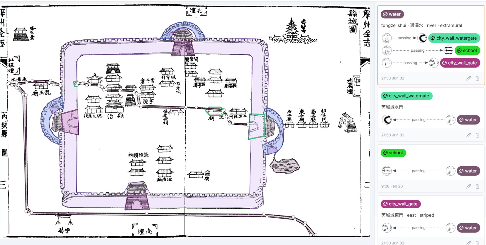
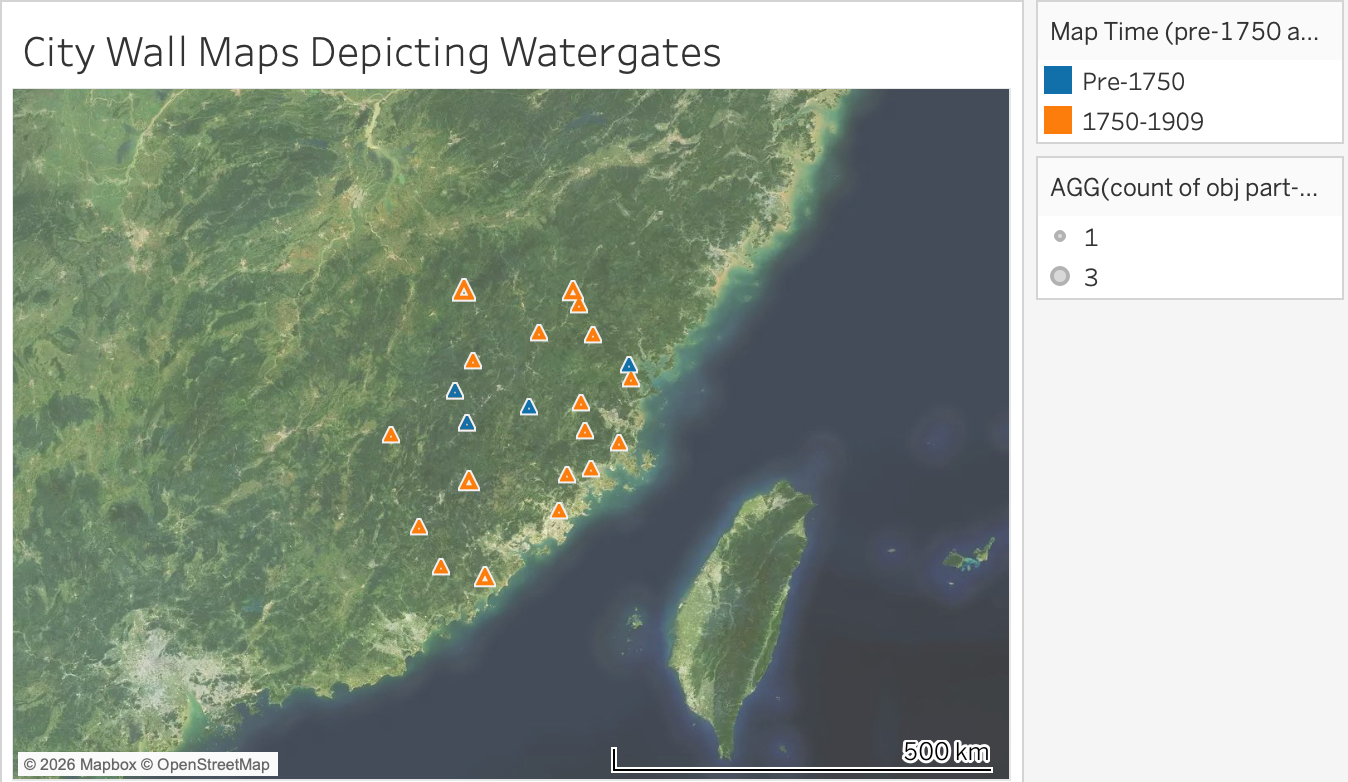
This paper explores how the cartographic depiction of city walls in local gazetteers functioned as a mode of place-making and knowledge production in late imperial China. Drawing on more than 200 city wall maps (chengtu) from county-level gazetteers of Shandong, Shanxi, Sichuan, and Fujian, it examines how representations of urban fortifications changed between 1500 and 1910 in response to geopolitical instability, local security crises, and environmental disruptions. Using the digital annotation platform IMMARKUS, Wang Ran, Pascal van der Bij, and I systematically annotated city walls, related infrastructures, and environmental elements in these maps. The analysis, conducted collaboratively by Dawn Zhuang, Hilde De Weerdt, Wangzhi Xi, and the author, highlights how the rendering of masonry textures, the addition of defensive structures such as barbicans and bastions, and the inclusion of hydrological features reflected local engagements with shifting social, material, and environmental realities. By situating these cartographic choices alongside the historical practices of city wall construction and repair, this paper demonstrates how local mapmakers translated the material processes of building, repairing, and fortifying city walls into visual knowledge—thereby shaping how urban spaces were conceived and remembered in the Ming-Qing period.