On November 24, Dr. Sunkyu Lee presented “Cross-Medial Mapping of Military Infrastructures in Early Modern China and Korea” at the MacLean–KU Leuven workshop “How Did They tu It?”
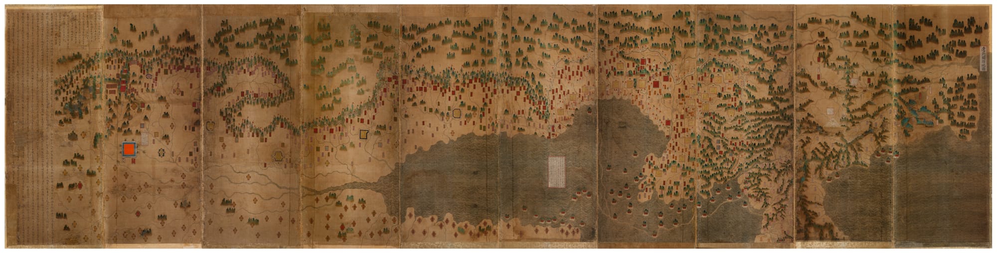
How was information about military infrastructures communicated across different audiences and regions, and what role did the materiality of maps play in this process? Between the sixteenth and eighteenth centuries, the Ming-Qing and Choson Korean courts produced maps of military fortifications along their northern frontiers. These maps were reproduced in a variety of formats—ranging from large folding screens and handscrolls to portable hand-drawn atlases and woodblock prints—each tailored to specific purposes and audiences. I focus in particular on folding screen maps, examining how their capacity to display a single, expansive image provided distinct advantages for strategic, didactic, and aesthetic purposes. This presentation explores how such cross-media production not only facilitated the creation, management, and repurposing of military infrastructures, but also shaped the meanings of these infrastructures, border spaces, and territorial authority. By emphasizing the materiality of maps, it highlights how mapping functioned as a cross-regional tool for strategic planning and oversight, while integrating disparate spaces and communities into a coherent political and territorial framework.